
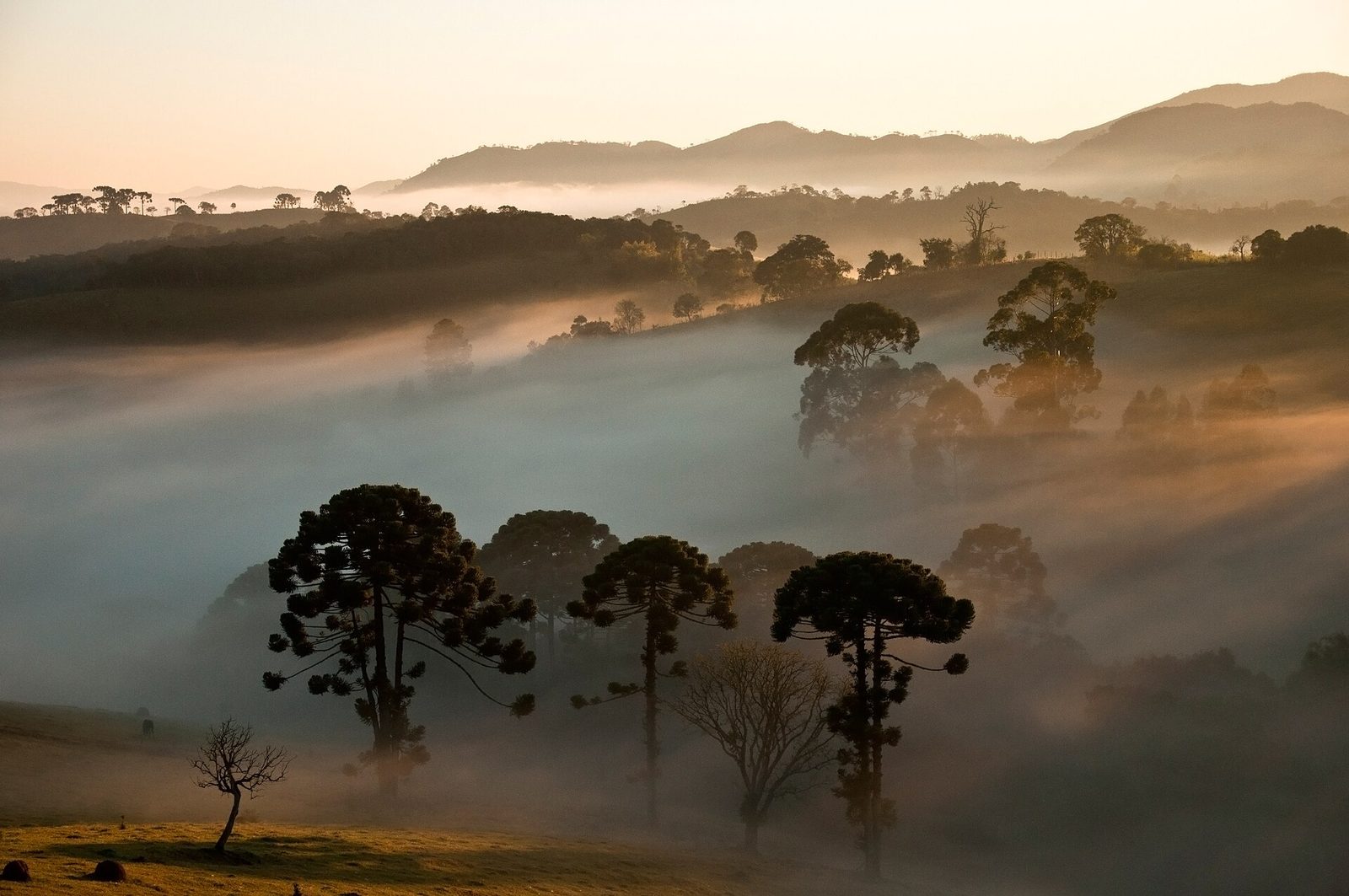
Stand anywhere in Paraty — the waterfront, a cobbled street, the deck of a boat out on the bay — and look inland. Behind the town the land does not roll away gently. It climbs, fast, into a wall of forested mountains that fills the whole western sky and disappears into its own cloud. That wall is the Serra do Mar, the coastal range that runs for hundreds of miles down southeastern Brazil, and the largest protected piece of it above Paraty has a name: Parque Nacional da Serra da Bocaina, the Serra da Bocaina National Park.
It is one of the great national parks of the Atlantic Forest. It straddles the border of two states, Rio de Janeiro and São Paulo, climbs from the edge of the sea to summits that rise past 2,000 meters, and protects a broad sweep of steep, wet, spring-fed mountain that feeds the rivers and waterfalls of the whole region. It is managed by ICMBio, the federal agency responsible for Brazil's conservation units, and it forms part of the larger protected mountain landscape that includes the forest around Reserva Sete Quedas itself.
This is the biggest and wildest of the places we cover in our local guides, and also the least tame. Most of it is not somewhere you drive to and photograph in an afternoon. It is a working wilderness of cloud forest, high grassland, and multi-day trails, and it rewards understanding before you go. What follows is an orientation: what the park is, why it holds so much life, what you can walk and see, how to reach it, and why its forests matter to every stream that falls past the reserve below.
- Name
- Parque Nacional da Serra da Bocaina, a federal park managed by ICMBio
- Location
- the Serra do Mar behind Paraty, on the Rio de Janeiro–São Paulo border
- Size
- more than 100,000 hectares of protected Atlantic Forest
- Range
- from near sea level to summits above 2,000 meters
- High country
- cloud forest below, open campos de altitude grasslands on the coldest tops
- Signature trek
- the multi-day Trilha do Ouro, the Gold Trail, descending toward the coast near Mambucaba
- Flagship animal
- the endangered southern muriqui, the largest primate in the Americas
- Recognition
- part of the Paraty and Ilha Grande UNESCO World Heritage Site
A wall of green behind Paraty
The Serra do Mar is one of the defining features of the Brazilian coast, a near-continuous rampart of mountains that rises almost straight out of the Atlantic and separates the narrow coastal plain from the high interior plateau. Along the stretch of coast behind Paraty this range takes the local name Serra da Bocaina, and the national park protects a large block of it. The word bocaina refers to a gap or opening in high country, and the park is exactly that kind of landscape: a tangle of ridges, saddles, deep valleys, and open tops, folded together on a scale that is hard to grasp until you are inside it.
The park is federal land, one of Brazil's national parks, administered by ICMBio, the Chico Mendes Institute for Biodiversity Conservation. It covers a large area — more than a thousand square kilometers of protected mountain — and because it sits astride the boundary between Rio de Janeiro and São Paulo states, it belongs, in a sense, to both. That border runs along the high country at the top of the range, so the park has two very different faces: a steep, hot, forested seaward side that drops toward Paraty and the coast, and a higher, cooler, more open inland side above the São Paulo town of São José do Barreiro.
It does not stand alone. The Serra da Bocaina park is one piece of a much larger fabric of protected areas along the Serra do Mar — state parks, private reserves, and other conservation units that together form one of the largest surviving expanses of Atlantic Forest anywhere. That connectivity is the whole point. A protected block that adjoins other protected land lets animals move, lets plants spread, and lets the forest keep working as a system rather than as a scatter of islands. The forest around Reserva Sete Quedas, farther down the same slopes, is part of this same connected mountain landscape.
In fact the park anchors a whole mosaic of neighboring protected areas along this coast — national and state parks, environmental protection areas, and private reserves — that conservation planners increasingly manage with an eye to the whole rather than to each piece alone. Grouped under the name of the Bocaina mosaic, these units add up to something far larger and more resilient than any single reserve could be. It is a good way to think about the entire region: not a scatter of separate green dots on a map, but one great, mostly continuous mountain forest held under a patchwork of different owners and rules, all of it pulling, more or less, in the same direction.
From the coast to the clouds: the altitude gradient
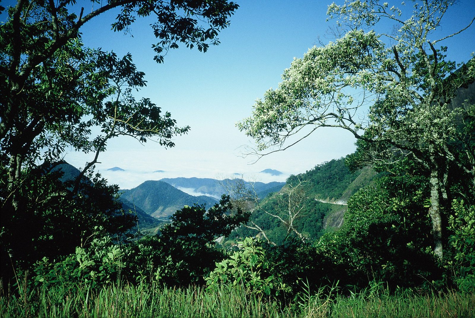
The single most important fact about the Serra da Bocaina, the thing that explains almost everything else, is that it climbs. In a relatively short horizontal distance the land rises from sea level to summits that top 2,000 meters. That vertical sweep is what makes the park so rich, because climate changes with height. Every few hundred meters of elevation brings cooler air, different rainfall, different soil, and, as a result, a different kind of forest with a different set of plants and animals. A park that spans this much altitude is really several ecosystems stacked on top of one another, and a walk that gains height is a walk through all of them.
The warm lowland forest
At the bottom, near the coast, is the warm, humid lowland and submontane rainforest. This is the classic Atlantic Forest of the picture books: tall trees hung with vines and epiphytes, dense understory, palms, and a heavy wet heat that never quite lifts. It receives some of the highest rainfall in Brazil, because the mountains wring the moisture out of the ocean air. This is the forest you move through first if you climb from the Paraty side, and it is the band that has been most exposed to human pressure over the centuries, since the lower slopes were the easiest to reach and clear.
The montane forest and the cloud belt
Higher up, the forest changes. The trees grow shorter and more gnarled, the air turns cooler, and clouds begin to sit on the slopes for much of the day. This is montane and upper-montane forest, and near the top it becomes true cloud forest — a world of constant mist, dripping leaves, and branches so loaded with mosses, ferns, bromeliads, and orchids that the trees themselves seem upholstered in green. The cloud forest is one of the treasures of the park, and one of its most fragile parts, because the species that live in this narrow, wet, cool band have nowhere to go if conditions shift. It is here that the park's water begins its journey down the mountain.
Why the stacking matters
Stack all of this up — lowland rainforest, montane forest, cloud forest, and, above them, open grassland — and you begin to see why the park holds so much. Each band is a different set of conditions, and each has evolved its own specialists: plants and animals suited to that exact combination of warmth, cold, wet, and light, and often found nowhere else. The narrow transition zones between the bands add still more, because they mix species from both sides. A single mountain that runs from the beach to a cold summit is, in effect, a stack of separate worlds, and the Serra da Bocaina protects the whole stack in one continuous sweep. That is the engine of its biodiversity, and it is why altitude, more than anything else, is the key to reading this park.
Grasslands in the sky: the campos de altitude
Above a certain height the forest gives out altogether and something unexpected takes its place: open grassland. These high, treeless meadows are called campos de altitude, the high-altitude fields, and they cap the coldest, windiest, most exposed summits of the range. After hours of walking through closed forest, to come out onto these open tops — rolling grass, low shrubs, bare rock, and a huge sky — is one of the more striking transitions the park offers.
The campos are not forest that failed to grow. They are their own ecosystem, shaped by cold, wind, thin soil, and, in winter, frost. The plants here are specialists: tough grasses, ground-hugging shrubs, and small flowering herbs adapted to conditions that would kill a lowland plant. Many of them are found only in these island-like patches of high country scattered along the tops of the coastal ranges, which makes the campos hotspots of endemism in their own right. A little flower growing between the rocks up here may live nowhere else in the world but on a handful of neighboring summits.
This is also the coldest part of the park by a wide margin. The highlands can be genuinely cold — nights near or below freezing in winter, frost on the grass, and cloud that can close in and drop the temperature in minutes at any time of year. The contrast with the hot coast a short distance away, and far below, is total. Two people could stand in the same national park on the same afternoon, one sweating in lowland forest near the sea and one pulling on a jacket against the wind on a frosted grassland, and both would be right about where they were.
Orchids, bromeliads, and the life of the cloud forest
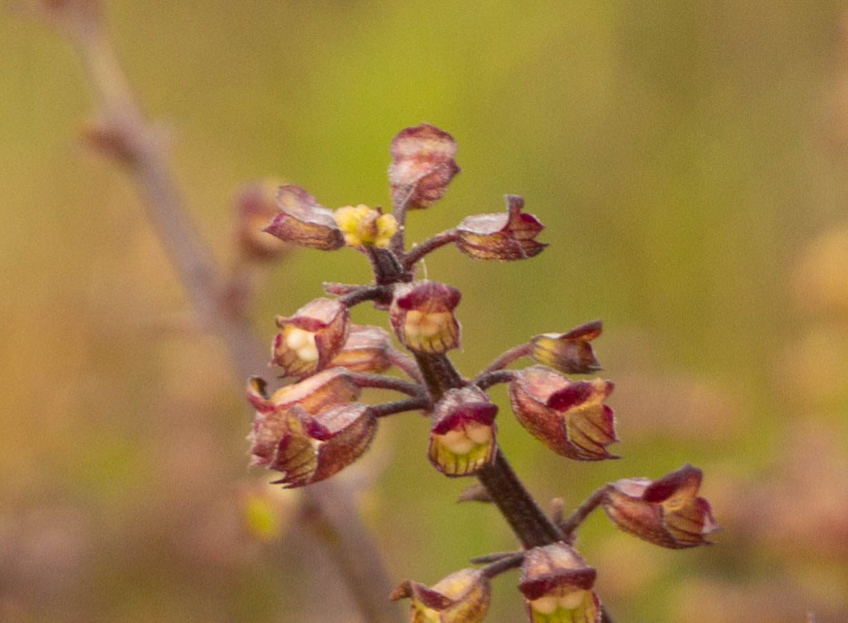
If the altitude gradient is the park's skeleton, the plants that ride its wettest slopes are its most visible glory. The cloud belt of the Serra da Bocaina, where mist sits in the trees for much of the day, is one of the richest places for epiphytes anywhere — plants that grow perched on other plants, using them only for a foothold in the light, taking their water and nutrients straight from the moist air and the rain.
Orchids are the famous ones. The Atlantic Forest holds an enormous diversity of orchids, many of them small, subtle, and easy to miss, tucked into the fork of a branch or the moss on a trunk rather than hanging in showy sprays. A single tree in the cloud forest can carry dozens of species of epiphyte on its limbs. Alongside the orchids grow bromeliads, those stiff rosettes that catch and hold rainwater in their centers, forming tiny pools high above the ground that shelter frogs, insect larvae, and a whole miniature world of life that never touches the forest floor.
Add to these the ferns, the tree ferns with their coiled new fronds, the mosses and liverworts that coat every wet surface, and the fungi that break down the endless fall of leaves, and you have a forest that is green from the ground to the top of the canopy and covered, layer upon layer, in still more life. It is worth slowing down for. The great wonders of this forest are mostly small ones, and they reward the walker who stops and looks closely at a single branch rather than hurrying on to the next viewpoint.
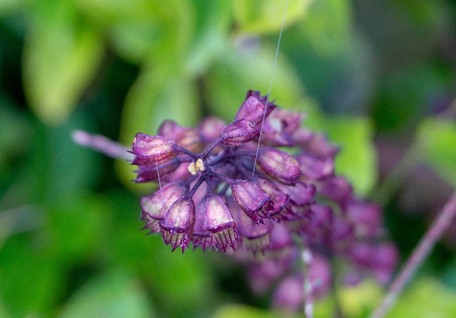
The same abundance of orchids, bromeliads, and epiphytes covers the protected forest around the reserve, which sits on these very slopes. It is one of the surest signs that you are in a healthy piece of Atlantic Forest rather than a drier, poorer woodland.
The muriqui and the animals of the park
A forest this large and this connected can still hold animals that have vanished almost everywhere else, and the Serra da Bocaina is a genuine stronghold for some of the Atlantic Forest's rarest wildlife. Knowing what lives here changes how you walk, even if — as is usually the case with the shyest species — you never actually see them.
The southern muriqui
The flagship is the southern muriqui, the woolly spider monkey, the largest primate in the Americas and a creature that lives only in the Atlantic Forest. It is a big, long-limbed, woolly monkey that moves through the high canopy, and it is endangered, its numbers cut down and scattered by the loss of the forest around it. Muriquis are unusual animals in temperament as well as size, known for being remarkably peaceable, living in groups without the aggression that marks many other monkeys. They need large, connected tracts of forest to survive, which ties their fate directly to big protected blocks like this one. To share a forest with muriquis is to stand in one of the last places that can still hold them.
To share a forest with muriquis is to stand in one of the last places on Earth that can still hold them.
Cats, tapirs, and the shy mammals
The park is large enough to matter for big, wide-ranging mammals. The great cats of the Americas are present in the broader landscape — the jaguar, the onça-pintada, and the smaller puma, the onça-parda — surviving where the forest is largest and the prey is healthy. They are rarely seen, and we will not promise a sighting; their presence is measured in tracks, in prey, and in the sheer area of intact forest they require. The lowland tapir, Brazil's largest land mammal, moves through the best-preserved parts, along with brown howler monkeys whose dawn calls carry for miles, peccaries, ocelots, coatis, and many smaller creatures of the night.
Birds, frogs, and the small life
For birds, the park is exceptional. The Atlantic Forest is one of the world's great centers of bird diversity and endemism, and the range of altitudes here stacks many different bird communities on top of one another, from the hot lowland forest to the cold open tops. Among the residents you might hope to see or hear:
- Toucans and toucanets, whose calls are among the classic voices of this forest.
- Tanagers in improbable colors, along with hummingbirds, trogons, and cotingas.
- Guans and other large forest birds, including species that have grown scarce elsewhere.
- A long list of small endemic songbirds that keen birders travel a long way to find.
Birds are not the whole of it. The Atlantic Forest is also one of the planet's great centers of amphibian diversity, and the wet, cool slopes of a range like this are full of frogs — many of them tiny, many found only within a narrow band of these mountains, calling from the leaf litter and the water held in bromeliads. Add the reptiles, the countless insects, and the spiders and other small creatures that do the quiet work of the forest, and the true measure of the park's life is not the handful of large animals you might glimpse but the uncountable small ones you walk past without seeing. A healthy forest is loud and crowded at every scale.
The Trilha do Ouro: the Gold Trail down the mountain
The most famous way to experience the park is on foot, along the Trilha do Ouro — the Gold Trail. This is a long, descending trek that starts high in the campos and forest of the São José do Barreiro highlands and drops down the seaward escarpment toward the coast near Mambucaba, following in part the line of an old colonial road once used to move gold. It is one of the classic treks of southeastern Brazil, and doing it is a serious undertaking rather than a day walk.
What the trek is like
The Trilha do Ouro is a multi-day route, most often walked over about three days, sleeping in simple shelters or camps along the way. Because it descends the full height of the range, it takes you down through the park's ecosystems in sequence, and that is a large part of its appeal. You start in the cold, open high country and finish in warm lowland forest, watching the world change around you as you lose altitude:
- The open campos de altitude and their frost-hardy grasses and flowers, high and cold.
- The upper cloud forest, dripping and mossy, where the mist sits longest.
- The montane forest, taller and greener as the slope steepens.
- The warm lowland rainforest near the bottom, humid and dense, closing toward the coast.
Waterfalls along the way
The trail is famous for its water. As it descends the wettest face of the range, it passes a series of waterfalls, pools, and rushing streams, the runoff of the whole high country funneling downhill beside you. The best known is the Cachoeira Santo Isidro, a tall and powerful waterfall that is one of the highlights of the whole trek. Because the route follows the escarpment down, the sound of falling water is a near-constant companion, and the chance to swim in a cold, clear mountain pool is one of the rewards for the effort. This is the same abundance of falling water that gives the whole region its character, and that feeds the seven waterfalls far below the reserve.
Walked from top to bottom, the Trilha do Ouro is a kind of summary of the whole park in a single journey: the cold open heights, the dripping cloud forest, the falling water, and the warm green lowland where the mountains finally meet the coast. It is demanding, and it is not for everyone. But for a fit and well-guided walker it is one of the most complete ways to understand what the Serra da Bocaina actually is, because you feel the entire range pass under your feet in the space of a few days.
Two ways in: the highland side and the coast
The park's split personality — cold highland on one side, hot forest on the other — means there is no single front gate. How you experience the Serra da Bocaina depends a great deal on which side you approach from, and the two sides feel like different worlds.
The São José do Barreiro highlands
The main developed access to the high country is on the São Paulo side, from the town of São José do Barreiro, up in the Paraíba valley behind the range. From there a rough mountain road climbs steeply into the park's highland core, reaching the campos de altitude and the upper trailheads, including the top of the Trilha do Ouro. The road up is genuinely rough — often requiring a high-clearance or four-wheel-drive vehicle, and best not attempted casually, especially in the wet — but it is the way into the open high country, the grasslands, and the classic through-treks. This is the side to approach if the high plateau and the descent trek are your goal.
The Paraty and Mambucaba side
From Paraty and the Costa Verde, you meet the park at its lower, seaward reaches. This is the hot, forested foot of the range, where the escarpment drops toward the coast near Mambucaba and the mouth of its river. The lower end of the Trilha do Ouro comes out on this side, so through-hikers descending from the highlands finish here, closer to Paraty. For a visitor based on the coast, this side offers forest walks, waterfalls, and the lower slopes rather than the high grasslands, and it connects naturally with the other forest and gold-road walking around Paraty. It is the side most guests staying near the coast will actually touch.
Whichever side you choose, the park is big, wild, and lightly developed by design. There are no resorts inside it and few facilities. That is not a shortcoming; it is the point of a national park of this kind.
Guides, permits, and how hard it really is
The Serra da Bocaina is not a place to wander into unprepared, and the rules around it reflect that. For the serious routes, and the Trilha do Ouro in particular, you generally need to arrange authorization with the park in advance and to walk with a licensed local guide. This is partly about protecting the forest — controlling numbers, keeping people to the trails — and partly about protecting the walker, because this is remote, rugged country where the weather turns fast and a wrong turn has consequences.
Difficulty should not be underestimated. The classic descent is long, steep, and physically demanding, with slippery footing on wet rock and roots, river crossings that can rise quickly after rain, and enough distance and elevation change to test anyone who is not reasonably fit. The high country adds cold, wind, and the real possibility of being fogged in. None of this makes the park off-limits to ordinary walkers, but it does mean the park asks for respect, preparation, and, on the big routes, expert local company.
Do not take the big routes alone
For the Trilha do Ouro and the highland treks, arrange authorization and a licensed guide before you go. A good guide reads the weather, the river levels, and the trail in ways a map cannot, keeps you on the route in fog, and knows what to do if something goes wrong. This is remote country with no quick way out, so the guide is not a formality but a safety measure. The reserve can help point you toward reputable local guides and operators — just ask when you plan your stay.
For gentler contact with the same forest, you do not need to commit to a multi-day expedition at all. The lower slopes near Paraty, the restored sections of the old gold road, and the trails on and around the reserve offer the character of this mountain forest — the trees, the birds, the falling water — at a scale a family or a casual walker can enjoy in a morning, with far less logistical weight.
Water from the mountains: the park as a watershed
Strip away the trekking and the wildlife for a moment and the park does one quiet, enormous thing that matters to everyone downstream: it makes and protects water. The seaward slopes of the Serra da Bocaina catch the moist air blowing in off the Atlantic and force it upward, wringing out some of the heaviest rainfall in the country. That water does not simply run off. It is caught by the forest — by the canopy that softens the rain, the roots that hold the soil, the deep spongy layer of leaf litter and moss that soaks it up — and released slowly, steadily, into springs and streams that run clear even in dry weather.
This is the origin of the region's rivers and waterfalls. The streams that tumble down these mountains, the falls that draw visitors all along this coast, and the water that fills the taps of the towns below all begin as rain caught by intact forest high in the range. Damage that forest and you do not just lose trees; you lose the steady, clean flow of water that everything downhill depends on. Protect it, and you protect the whole watershed.
The waterfalls people travel to see all begin as rain, caught and held by intact forest high in the mountains.
This is exactly the connection between the national park and Reserva Sete Quedas. The reserve sits on these same wet slopes, above its own seven waterfalls, and the streams and springs that make those falls are fed by the same forested, rain-catching high country the park protects. Guarding forest here is guarding water there. The reserve's own protected acres and the vast park above are two parts of one watershed, and the health of the falls below depends on the forest staying whole above. You can read more about those falls in our guide to the waterfalls of Paraty.
A landscape shaped by gold and time
These mountains are wild, but they are not untouched by history. For a stretch of the 1700s, some of the gold that came out of the Brazilian interior crossed this very range on its way to the sea, carried by mule down stone-paved roads to the port of Paraty. The Trilha do Ouro takes its name — the Gold Trail — from that era, and parts of the old colonial road system, the Caminho do Ouro, threaded through the country the park now protects. The forest you walk through today has grown back over, and around, a great deal of human history, and the trained eye can still find old paving and the traces of who passed here.
That layering of nature and history is part of why the whole region carries international recognition. The Serra da Bocaina National Park is one of the protected areas inside the Paraty and Ilha Grande site that UNESCO has recognized as a World Heritage landscape valued for both its natural richness and its cultural history — a rare pairing that puts the forest, the old gold roads, and the colonial town of Paraty together as one exceptional place. The park is the wild, upland heart of that recognition.
It is worth holding both threads at once. The stones of the old roads are genuine engineering, laid overwhelmingly by enslaved people under brutal conditions to serve an economy of extraction, and the forest they run through is older and, in the long run, more important than the gold that briefly justified them. The gold is long gone. The empire that taxed it is gone. What remains is the mountain, the forest, and the roads, and the most honest way to walk here is to see all three at once. There is much more on that history in our guide to the Caminho do Ouro, the Gold Trail.
A forest under pressure
A national park sounds like a guarantee, but protection on paper is not the same as safety on the ground, and the Serra da Bocaina, like every large protected area in the Atlantic Forest, faces real and continuing pressures. The historic clearing that reduced this biome to a fraction of its original extent largely spared these steep mountains — they were too rugged to farm easily — but the threats did not stop. They simply changed shape.
The park still contends with a range of problems that any conservation-minded visitor should understand:
- Illegal hunting, which quietly empties a forest of its larger birds and mammals even where the trees still stand.
- The illegal cutting of wild juçara palm for its heart, palmito, which kills the tree and removes a food source many animals depend on.
- Fire, often set to clear land nearby, which can escape into forest and grassland that are not adapted to burn.
- Encroachment and unresolved land tenure, since parks of this age can still contain private inholdings and contested boundaries.
- Pressure from growing tourism and coastal development around the park's lower edges.
- Invasive species and, over the longer term, a shifting climate that presses hardest on the specialized life of the cloud forest and the high grasslands, which have nowhere higher to go.
None of this is cause for despair. The park endures, its forests are largely intact, and it remains one of the most important protected landscapes in the biome. But it is a reminder that a line on a map does not defend itself. Protection is ongoing work — patrolling, restoring, resolving boundaries, and managing visitors — and the surrounding private lands that keep their own forest standing, the reserve among them, are part of what buffers and reinforces the park rather than pressing in on it.
When to go, and what the mountain asks of you
Timing matters more here than in most places, because the park's weather is extreme in its own quiet way. The broad rule is that the cooler, drier months — roughly from April to September — make the best window for the high country and the long treks. Trails are firmer, rivers are lower and safer to cross, and the odds of a clear day on the tops are better. The warmer months, from around October to March, bring heavy rain, swollen and dangerous rivers, more cloud, and a real chance that treks are closed or simply miserable.
But no season is simple. The dry season in the highlands is also the cold season, and winter nights up in the campos can drop near or below freezing, with frost on the grass at dawn. The wet season, for all its hazards, is when the forest is most lush and the waterfalls are at their fullest. And in any month, on any day, cloud can roll up the seaward slopes and close the high country in fog within minutes. The mountain does not really have a safe, mild, predictable season; it has trade-offs, and the job is to match your plans to them.
Pack for cold and wet, even in the dry season
Whatever the calendar says, the high Serra da Bocaina can be cold, wet, and fogged in. Bring warm layers and a genuine waterproof shell for the highlands, grippy closed footwear for slick rock and roots, and more water than you think you need for the humid lower forest. Start early, check the forecast for the mountain rather than the coast, and be willing to turn back. The park rewards people who treat it seriously and punishes those who assume tropical Brazil is always warm.
For most guests based near the coast, the simplest approach is to enjoy the lower, gentler faces of this forest close to Paraty, and to treat the full highland experience as a planned expedition in the right season, with the right guide, rather than a spur-of-the-moment outing.
The same forest, seen from the reserve
It is easy to think of a national park as a separate destination — somewhere you go, and then leave. But the Serra da Bocaina is not a place apart from Reserva Sete Quedas. It is the larger body of the same forest the reserve is a small part of. The 800 acres of the reserve, with 500 of them held as continuous protected Atlantic Forest, sit on these same seaward slopes, in the same range, catching the same rain and feeding the same watershed. The muriquis, the toucans, the orchids, and the cloud that the park protects at scale are the same living fabric the reserve helps hold at the scale of a single property.
That is what a private, conservation-first reserve does at its best: it adds to the protected land around the big public parks, buffering their edges and helping bridge the gaps between blocks so that the whole mountain keeps functioning as one forest. The reserve is not a resort carved out of the wild. It is a working piece of conservation — an old organic banana farm and a strictly limited number of low-impact chalets — whose whole purpose is to keep a piece of this forest standing, and whose small footprint is the point. You can read how that fits into the wider biome in our guide to Mata Atlântica biodiversity, and about the animals you might actually meet on our wildlife of the reserve page.
You do not have to trek for days to feel the Serra da Bocaina. You can walk the reserve's own old pack roads and forest trails, described on our forest hikes and Gold Trail page, stand under its waterfalls, and understand, in your legs and your ears, that you are inside the same great mountain forest that fills the sky behind Paraty. And if the wild high country calls, you will be well placed to reach it, with knowledgeable local help, from a quiet base in the forest below. To do any of it, you can plan a stay with us. The park is the whole mountain; the reserve is a good place to stand inside it.