
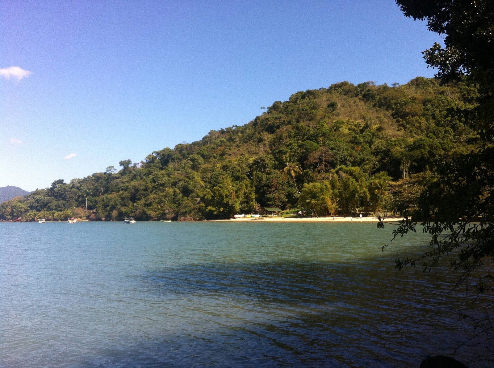
South of Paraty, past the last of the town's bay islands, the coast does something it does nowhere else along this shore: it opens a long, narrow arm of sea that reaches back inland between two walls of forested mountain. This is the Saco do Mamanguá. Turn a small boat into its mouth and the open Atlantic falls away behind you; ahead, the water narrows to a green corridor, still and sheltered, running back toward a head of mangrove and a scatter of houses at the foot of the hills. It is one of the quietest and most singular places on the whole Costa Verde, and it is the reason many people who know this coast well save it for last.
You will hear it called Brazil's only tropical fjord, and the name fits what your eye tells you — the long drowned valley, the steep sides, the calm dark water — even though, strictly speaking, it is not a fjord at all but a ria, a river valley drowned by the rising sea. We will come to that distinction honestly, because it is worth understanding. What matters first is that the Mamanguá is a living place, not a scenic blank. Its calm water grows oysters and shelters young fish, its shores hold caiçara families who have fished and farmed here for generations, its head is ringed by one of the best-kept mangroves on the coast, and a single steep granite peak rises above it with a view that takes in the whole bay at once.
This guide covers what the Mamanguá is and where it sits, the fjord-and-ria question in plain terms, the calm water and the mangroves that make it so rich, the oysters and the people who grow them, the climb up the Pico do Pão de Açúcar de Mamanguá, paddling and boating the length of the bay, the snorkeling and the quiet coves, where to sleep at the head of it, the birds and mangrove life, how to get there by sea or by road and trail, when to come, and how to visit a fragile, protected place without leaving a mark on it.
- Where
- A long, narrow bay on the southern side of the Paraty coast, Rio de Janeiro state
- Protected
- Inside the Área de Proteção Ambiental do Cairuçu, on the Juatinga peninsula
- Often called
- "Brazil's only tropical fjord," though geologically it is a ria — a drowned river valley
- Landmark
- The Pico do Pão de Açúcar de Mamanguá, a granite dome standing above the bay
- Known for
- Sheltered water, mangroves, oyster cultivation, and caiçara communities
- Getting there
- By boat from Paraty, or by road toward Laranjeiras and then boat or trail
- Signature hike
- A steep climb of roughly a couple of hours to the peak, for a view over the entire bay
- Best explored
- By kayak, stand-up paddle, or small boat, with an eye on the tide and the wind
What the Saco do Mamanguá is, and where it sits
The Mamanguá is a bay, but not the kind the word usually brings to mind. Instead of a broad curve of shore open to the sea, it is a long, narrow inlet that cuts back into the land, a corridor of calm water pressed between two ridges of the Serra do Mar. It lies on the southern side of the Paraty coast, on and around the Juatinga peninsula, the wild spur of mountain and forest that reaches out into the Atlantic below the town. From the water it reads as a kind of green trench in the mountains, filled with sea; from the ridgetops above, it reads as a still, dark ribbon threaded between forested slopes. Either way it is unmistakable, and once you have seen it you understand why it has its own name and its own reputation.
A bay you enter from the sea
You come into the Mamanguá through a mouth on its ocean side, where it opens to the sheltered water behind the islands south of Paraty. Pass through that opening and the character changes at once. The swell and the wind of the open coast drop away, the shores close in on either hand, and the boat settles onto flat water that can be almost mirror-still on a calm morning. From there the bay runs inland, narrowing as it goes, the forested slopes rising steeply on both sides so that the two shores stay in easy view of each other the whole way down. It is long enough that paddling its length and back is a full day's outing, and narrow enough that it never feels like open sea; the sensation is of being held between mountains, on water, with the ocean somewhere behind you and out of sight.
The head of the bay and its villages
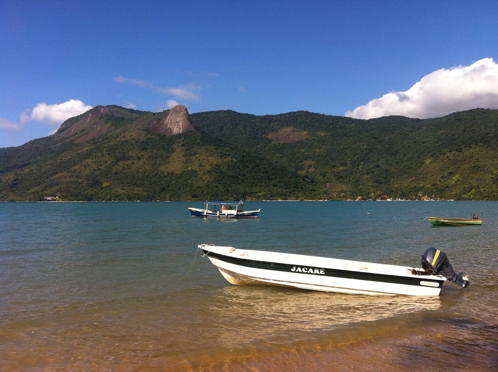
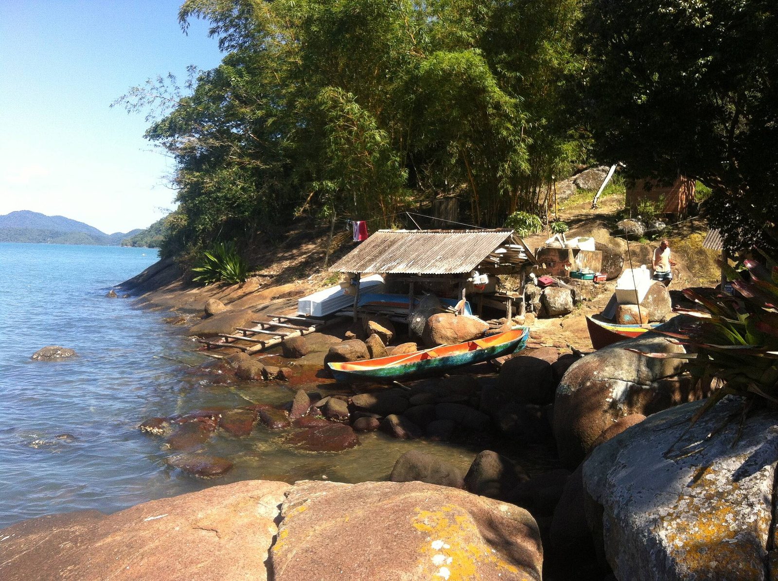
At the far, inland end — what locals call the fundo, the bottom of the bay — the water shallows and gives way to a broad mangrove, and around it lie the small communities that have long made the Mamanguá their home. This is where most visitors who stay overnight end up: a handful of simple pousadas and campsites, a jetty or two, canoes drawn up on the mud, and paths leading back into the banana plots and the forest. The head of the bay is the Mamanguá at its most lived-in and its most gentle, a place of shallow warm water, oyster racks, and the slow rhythm of a fishing and farming community. It sits inside the Área de Proteção Ambiental do Cairuçu, the protected area that covers this whole southern stretch of the Paraty coast, which is a large part of why it still looks and works the way it does.
Fjord or ria? Getting the geology right
The Mamanguá's nickname — Brazil's only tropical fjord, sometimes stretched to the only fjord anywhere near this latitude — is repeated on nearly every sign and in nearly every boatman's patter, and it is worth taking a moment to be honest about it, because the truth is more interesting than the slogan. The short version is this: the Mamanguá looks a great deal like a fjord, but geologically it is not one. It is a ria. The two can end up looking similar, but they are made in completely different ways, and the difference is the whole story of how this landscape came to be.
What a true fjord is
A true fjord is carved by ice. In the high latitudes — Norway, Chile, New Zealand, Alaska — great glaciers ground their way down existing river valleys during the ice ages, gouging them deeper and steeper and squaring off their walls, then retreated as the climate warmed and let the sea flood in behind them. The result is a long, deep, steep-sided arm of the sea, often with water far deeper inside the fjord than in the sea outside its mouth. Fjords are fundamentally products of glaciation, which is exactly why you find them where ice once lay thick on the land, and not in the tropics.
Why the Mamanguá is a ria
Here in the tropics there were no glaciers to do that work. The Mamanguá was cut not by ice but by water — a river, draining the mountains, wearing a valley down toward the coast over a very long stretch of time. Then, at the end of the last ice age, as the world's ice melted and sea level rose, the ocean pushed inland and drowned the lower part of that river valley. The sea filled the old riverbed, and what had been a valley became a long, narrow bay. That is a ria: a drowned river valley, flooded by rising sea rather than scooped out by ice. It explains the Mamanguá's shape exactly — the winding form of a river valley, the steep forested sides, the shallow and gentle bottom — without any need to invoke glaciers that were never here.
Why the "fjord" name stuck
None of this makes the nickname a lie, quite; it is a piece of shorthand for what the eye sees. A drowned valley ringed by steep, high, forested walls does genuinely call a fjord to mind, and "tropical fjord" is a vivid, forgivable way to say so. It is simply worth knowing what you are actually looking at, because the real explanation ties the Mamanguá to the same forces that shaped the rest of this coast: rivers coming off the Serra do Mar, and a sea that has risen and fallen over the ages. Call it a fjord, if you like, for the feel of it. Know that it is a ria, for the truth of it. The distinction takes nothing away from the place and adds a little to it.
It looks like a fjord and it is not one — it is a drowned river valley, and the truth is more interesting than the nickname.
The calm water and the mangroves
Two things make the Mamanguá as rich and as gentle as it is, and they are connected: the water is calm, and the head of the bay is a mangrove. Take those together and you have the recipe for one of the most productive small ecosystems on the coast, a nursery for fish and shellfish and a shelter for birds, all of it protected from the violence of the open sea by the simple shape of the land.
Why the bay stays so calm
Because the Mamanguá reaches so far back into the mountains through such a narrow mouth, the swell and the weather of the open Atlantic barely reach it. Waves that break hard on the outer beaches arrive here as almost nothing; the wind tends to funnel along the bay rather than pile up seas across it; and the water, for much of the day, lies flat and quiet, warm in the shallows and easy to move across. That calm is what makes the Mamanguá so good for paddling and for small boats, and it is also what lets the mangrove and the oyster beds do their work, since both depend on sheltered, slow-moving, brackish water rather than pounding surf. The shape of the land, in other words, is not just scenery; it is the engine of everything living that happens here.
The mangrove at the head
Where the fresh water of the streams meets the salt water of the bay, at the shallow inland end, the Mamanguá grows one of the best-preserved mangroves on this part of the coast. A mangrove is not much to look at if you do not know what you are seeing — a tangle of pale, arching roots standing in grey mud, trees that seem to walk on stilts out into the water — but it is among the most valuable habitats there is. Those roots trap sediment and slowly build land; they filter the water that runs off the slopes; they break the force of storms; and, above all, they are a nursery. Young fish, crabs, shrimp, and the very oysters the bay is known for begin life in the sheltered maze of the mangrove roots, where predators struggle to follow and food is abundant. Much of the life of the whole bay, and of the sea beyond it, is seeded in that muddy tangle. It is easy to paddle a kayak quietly to the edge of it and watch the crabs work the mud and the herons stalk the shallows, and doing so is one of the quiet pleasures of a stay at the head of the bay. It also makes plain why the mangrove is protected, and why walking or digging in it is not on: pull a thread here and the damage runs right up and down the food chain.
Oysters, and eating them on the water
If the Mamanguá has a signature flavor, it is the oyster. The same calm, brackish, nutrient-rich water that makes the bay such a good nursery makes it ideal for growing oysters, and oyster cultivation has become one of the mainstays of the communities around its shores — a livelihood that depends, directly and obviously, on keeping the water clean.
How the oyster farms work
Oyster farming here is a small-scale, hands-on affair, worked by local families rather than any large operation. In simple terms, the growers give the young oysters something clean to settle on and then hang them out in the bay in racks, baskets, or on lines, down where the tide keeps them fed. The oysters do the rest, filtering the rich water and growing until they are ready to harvest, a process of months. You will see the racks and floats out on the water as you paddle or motor down the bay, and around the head of the Mamanguá you will see the rest of the operation on shore: the sorting, the cleaning, the piles of shell. It is a good example of a way of making a living from the sea that, done at this scale and with this care, sits lightly on the place — the oysters actually clean the water as they grow, and the growers have every reason to guard the bay that feeds them.
Eating them where they grow
The reward for the visitor is obvious and delicious: oysters eaten fresh, often within sight of the racks they came off, sometimes handed to you straight from the water on a boat trip and opened in front of you with a knife and a squeeze of lime. There is no fresher way to eat a shellfish than this, and there is something clarifying about eating an oyster in the very water that grew it, tasting the bay directly. Local families and small operators sell and serve them around the shores, and a stop for oysters is a standard and worthwhile part of a boat or kayak trip down the Mamanguá. If raw shellfish is not for you, they are also cooked — grilled over coals, or dropped into a hot broth — and either way they are the taste most people carry away from the place. As always with raw seafood, use ordinary good sense about who you buy from and how the oysters have been kept; bought from the people who grow them, on the water, they are about as fresh as anything you will eat.
The calm that makes the bay beautiful is the same calm that grows the oysters and feeds the people who live along it.
The caiçara communities of the bay
The people who live around the Mamanguá are caiçaras, the traditional coastal communities of this part of Brazil, descended over centuries from Indigenous peoples, Portuguese settlers, and Africans, and shaped by a way of life built around the sea, the forest, and small patches of cultivated ground. They are not a display put on for visitors; they are living communities, and their presence is a large part of what the Mamanguá is. To visit the bay is to be a guest in their home water.
A life between forest and sea
The caiçara way of life here has always been a matter of taking a little from several sources rather than a lot from any one. Traditionally that meant fishing the bay and the coast, growing manioc and beans and bananas in clearings on the slopes, gathering from the forest, and, in the old days, making manioc flour in communal houses with the big presses and toasting pans. The Mamanguá, sheltered and productive, suited that life well, and families have lived around its shores for generations, reaching their homes and plots by canoe and on foot along trails, since for most of them there has never been a road. Today the mix has shifted — oyster farming and a careful kind of tourism now sit alongside the fishing and the small farming — but the shape of it endures: a life lived close to the water, at the pace the water sets. You can read more about this culture across the wider region in our guide to caiçara life on the Costa Verde, which sets the Mamanguá's communities in their broader context.
Visiting with respect
Because these are homes and not attractions, how you behave matters. The communities of the Mamanguá and the wider Juatinga peninsula have, within living memory, had to defend their right to remain on land their families have worked for generations, against pressure from outside speculation and against rules that did not always account for the people already living inside the protected area. That history is worth carrying with you as a visitor. Buy oysters, meals, and guiding from local families; ask before photographing people, their homes, or their boats; keep to the paths and the shore; and take every scrap of your rubbish back out with you, since there is no one here to clear up after a careless guest. The warmth you meet on the Mamanguá is real, and it is repaid by treating the place as what it is: someone's home, not a backdrop.
Climbing the Pico do Pão de Açúcar de Mamanguá
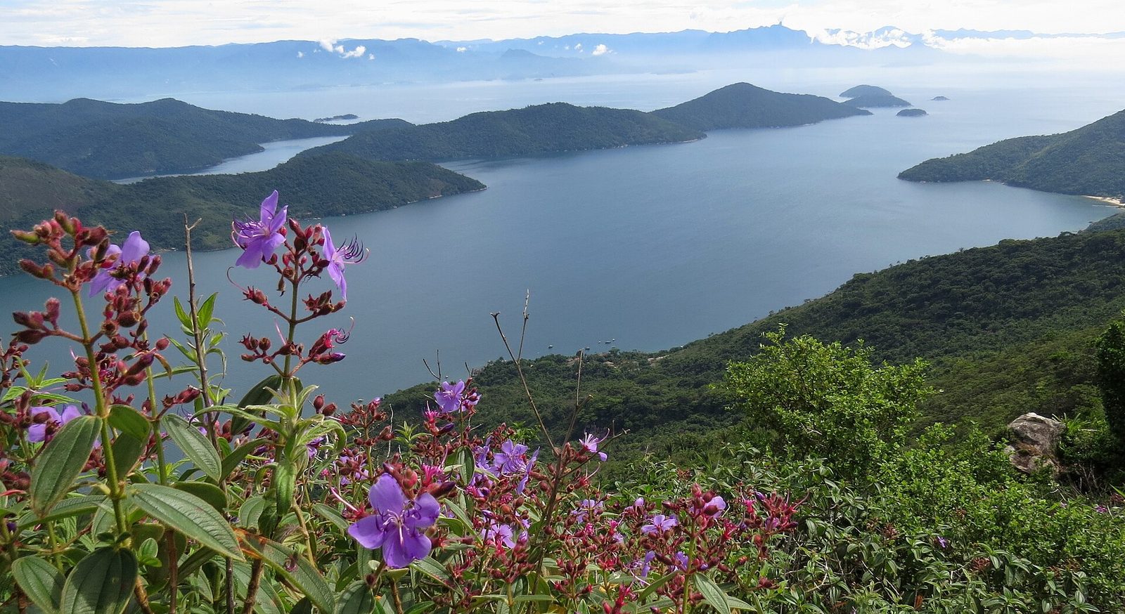
Rising above the bay is the reason many people come at all: the Pico do Pão de Açúcar de Mamanguá, a dome of bare granite that stands over the mouth of the inlet with a view from its top that takes in the entire fjord at once, the sea beyond, and the islands off the Paraty coast. The climb to it is the signature walk of the Mamanguá, and one of the finest short-but-serious hikes anywhere on this coast. It is not a stroll, and it should not be treated as one, but for anyone reasonably fit it is well within reach and thoroughly worth the effort.
The trail and how hard it is
The walk climbs from near the shore up through forest and then out onto the open granite of the peak, and it is steep for most of its length — a sustained, sweaty ascent of a couple of hours rather than a gentle grade, with sections where you use your hands and, near the top, exposed rock where a slip would matter. It is the kind of trail that rewards steady legs and a head that is comfortable with a little height and exposure. None of it is technical climbing, but it is real hiking, and the last stretch across the bald granite is best treated with respect, especially if the rock is wet or the wind is up. Good shoes with grip are not optional here; sandals and worn soles are how people get hurt.
Going with a guide, and when
Go with a local guide. This is not a formality — the route is not always obvious, the granite is unforgiving of a wrong step, and a guide from the bay knows the trail, the conditions, and the safe line across the top, as well as the stories of the place. Guides are arranged easily through the pousadas and communities at the head of the bay, and hiring one also puts money directly into the local economy, which is the right way to visit. On timing: most people climb early in the morning or in the later afternoon to avoid the worst of the heat, and some go up for sunrise or sunset, which is spectacular but adds the complication of walking part of the exposed trail in poor light — one more reason to have someone who knows it beside you. Carry more water than you think you will need, because there is none on the climb and the tropical sun on bare rock is punishing.
Treat the Pico as a real climb, not a photo stop
The view is worth every step, but the peak has hurt careless walkers. Go with a local guide; wear proper shoes with grip; carry plenty of water and sun protection; and start early or late to stay out of the midday heat. Do not attempt the bald granite in the rain or high wind, when it turns slick and genuinely dangerous, and do not push a tired or nervous member of the group up the last exposed stretch. The mountain will still be there next calm morning.
The view from the top
What waits at the summit is the picture that put the Mamanguá on so many lists: the whole long bay laid out below you, a dark, still ribbon of water winding back into the green mountains, the mangrove at its head, the oyster racks like tiny stitches on the surface, the open sea and the scattered islands beyond the mouth, and, in season, wildflowers and hardy shrubs clinging to the rock around your feet. It is the one place where you can see the entire shape of the fjord at once and understand it as a whole — a drowned valley, held between ridges, open to the sea at one end and closed by mangrove at the other. Give yourself time at the top to take it in, and to let your legs recover, before the knee-testing descent back to the water.
On the water: paddling and boating the bay
The best way to know the Mamanguá is from its surface, moving slowly. The bay's calm is made for small, quiet craft, and whether you paddle it yourself or ride a boat down it, the length of the inlet — from the mouth to the mangrove at the head — is the classic way to experience the place. Each way of doing it shows you something a little different.
Kayak and stand-up paddle
Because the water is so sheltered, the Mamanguá is one of the finest places on the coast for kayaking and stand-up paddleboarding. You can put in near the head of the bay and work your way along the shore, past the oyster racks and the mangrove edges, into little coves, with the forested slopes rising straight out of the water beside you and, often, not another soul in sight. It is quiet, close-up travel — you hear the birds, you see the crabs and the fish in the shallows, you can nose right up to the mangrove roots — and it is within reach of anyone reasonably comfortable on the water, since the bay rarely gets rough. Boards and kayaks can be rented or arranged through the pousadas at the head of the bay, and a half-day paddle is one of the great gentle pleasures of the place.
Reading the tide and the wind
Gentle does not mean it can be taken for granted. Two things shape a paddle on the Mamanguá, and both deserve attention. The first is the tide: much of the bay is shallow, especially toward the mangrove at the head, and a low tide can leave you dragging over mud or cut off from where you meant to go, so it pays to know whether the water is rising or falling before you set out. The second is the wind, which tends to be lightest in the early morning and to strengthen as the day warms, funneling along the bay in the afternoon. The sensible rhythm is to paddle early, when the water is glassiest and the wind is down, and to plan your route so that any hard paddling into the wind comes at the start rather than at the end of a tiring day. A little planning around tide and wind turns a potentially awkward outing into an easy one.
Coming by boat from Paraty
If you would rather be carried, the Mamanguá is a regular destination for boat trips out of Paraty, whether on a scheduled tour that takes in the fjord along with other stops or on a small private boat hired for the day. A boat lets you cover the length of the bay without effort, stop for oysters and a swim, and get out onto the water even if you are based in town rather than staying at the head of the bay. The trip down from Paraty is itself a fine cruise through the sheltered island water south of the town before you turn in through the mouth of the fjord. Our guide to Paraty's islands and boat tours covers how these trips work, what to expect, and how the Mamanguá fits into a day on the water alongside the bay's beaches and islands.
Snorkeling and the quiet coves
The Mamanguá is not primarily a snorkeling destination in the way the outer islands are — its water, fed by the mangrove and the streams, is often greener and softer than the clear blue you find around the rockier offshore islands, and visibility comes and goes with the rains and the tide. But it has its rewards for anyone who likes to get in the water and look, especially in the clearer coves near the mouth and along the rocky shores, and it is an easy, safe place to swim.
Along the bay's edges, where the forest comes down to meet the sea and the shore turns rocky rather than muddy, you find small coves with clearer water and rock life worth a mask and snorkel: reef fish going about their business among the boulders, urchins and crabs tucked into the crevices, the occasional larger fish cruising through. It is gentle, undramatic snorkeling, well suited to families and to anyone who wants to float and potter rather than dive, and the calm of the bay means there is rarely any current or swell to fight. The water is warmest and clearest in the sheltered shallows on a calm day a few days after any rain, once the streams have stopped pushing sediment into the bay.
For the clear-water, coral-and-fish snorkeling that this coast is famous for, you are better off out at the islands off Paraty, where the water runs blue and visibility is greater; our guide to diving and snorkeling on the Costa Verde covers where to go for that. Think of the Mamanguá's snorkeling as a pleasant addition to a day on the bay rather than the reason to come — a way to cool off and see what lives along the shore between a paddle and a plate of oysters. The reason to come is the bay itself: the shape of it, the calm, the mangrove, the peak, and the quiet.
Where to stay: camping and simple pousadas at the head of the bay
The Mamanguá is not a place of hotels. What you find at the head of the bay, and tucked along its shores, is the simplest kind of lodging — small family-run pousadas and campsites, most of them reached only by boat or on foot, most of them without the comforts a resort would offer, and all the better for it. Staying overnight on the bay is a different and deeper experience than passing through on a day trip, and for many people it is the whole point.
Expect simplicity. The pousadas and camps around the fundo are modest places run by local families: a few rooms or a patch of ground for a tent, home cooking built around the day's fish and the bay's oysters, cold water more often than hot, and power that may run on a generator or solar for only part of the day. Phone signal is patchy to absent. What you get in exchange for the missing luxuries is the thing you actually came for: the bay at dawn before any boat has stirred it, the mangrove waking up with birds, the stars over the water at night with no town glow to dim them, and the quiet company of a working community. For anyone willing to trade comfort for immersion, a night or two at the head of the Mamanguá is a memory that outlasts a lot of grander stays.
Day trip or overnight?
You can see the Mamanguá in a day from Paraty — a boat down the fjord, oysters on the water, a swim, and back — and many people do exactly that. But the bay rewards an overnight more than almost anywhere on this coast: staying at the head lets you climb the Pico in the cool of early morning, paddle the glassy water before the day boats arrive, and see the mangrove and the stars without a crowd. If you can spare a night, give it one.
A few practical notes for an overnight. Bring cash, since there is nowhere to draw money and cards are of little use here. Bring any medicines and specifics you need, insect repellent for the mangrove edges at dusk, and a torch. Pack light enough to carry your own bag from a boat across a beach or along a path. And book ahead in the busy season rather than turning up on spec, since the places are small and fill quickly. Above all, come in the spirit of the place: this is rustic, community-run lodging in a protected area, not a serviced escape, and the guests who enjoy it most are the ones who arrive expecting exactly that.
Birds and the life of the mangroves
For a naturalist, or simply for anyone who likes to watch, the Mamanguá is quietly rich. The meeting of forest, mangrove, and sheltered sea gathers a great deal of life into a small compass, and because so much of it happens in the open — along the shore, over the water, at the mangrove edge — it is often easier to see here than in the closed forest of the mountains.
The mangrove and the shallows are the heart of it. Herons and egrets stalk the mud at low tide; kingfishers work the shallows; and, where the bay meets the sea, frigatebirds and other seabirds ride the air over the mouth. The mangrove roots and the structure of the oyster racks shelter crabs, shrimp, and young fish in numbers, which is exactly why the birds are there. Paddle quietly along the edge in the early morning and you will see the whole chain at work — the crabs on the mud, the small fish in the water, the birds that live on both. It is an unshowy kind of wildlife watching, but a satisfying one, and it asks nothing of you but patience and quiet.
Behind the shore, the same Atlantic Forest that clothes the mountains at the reserve rises straight off the bay, and it holds the same wealth of forest birds — tanagers, toucans, flycatchers, and the many species you hear far more often than you see. The Mamanguá is a fine place to appreciate how the forest and the water feed one another: the streams that run off the wooded slopes carry nutrients down into the bay, the mangrove turns that richness into a nursery, and the whole living system depends on the forest above staying intact. If birds are what draw you, the same families fill the valleys at the reserve above the seven waterfalls, and much of what you learn to look and listen for here you will meet again up in the mountains. Keep your distance from nests and roosts, resist any urge to feed anything, and let the animals set the terms of the encounter.
How to get there
The Mamanguá is close to Paraty as the crow flies, but reaching it still takes a little doing, because it sits on the roadless, protected Juatinga peninsula and there is no highway to its shore. There are two main ways in — by boat across the water, or by road as far as the road goes and then by trail or boat — and which suits you depends on where you are staying, how much you are carrying, and how much walking you want to do.
By boat from Paraty
The simplest approach for most visitors is by water. Boats run to the Mamanguá from Paraty and from the nearer beaches to the south of the town, crossing the sheltered island water and turning in through the mouth of the fjord. From Paraty itself it is a cruise of an hour or two depending on the boat; from closer launching points such as Paraty-Mirim, the ride is shorter. A boat is the easiest way to arrive if you are staying at the head of the bay with luggage, and it doubles as a sightseeing trip in its own right, taking you past islands and beaches on the way in. Scheduled tours and private hires both serve the bay, and arranging one is straightforward from Paraty; the same boats that run the island tours often include the Mamanguá on their route.
The road-and-trail via Laranjeiras
The other way in is partly overland. A road runs south from the Paraty area toward Laranjeiras, the small settlement that serves as the jumping-off point for this whole corner of the coast, and from there you continue to the bay by a combination of trail and boat depending on exactly where you are headed. Laranjeiras is the same gateway used by walkers heading over the peninsula to the ocean-side beaches; the well-known trek to the beach at Praia do Sono starts from this same area, and our guide to the Praia do Sono trek covers that side of the peninsula in detail. For the Mamanguá, the practical thing is to arrange your access in advance with wherever you are staying, since the last stretch is not a matter of simply driving up and parking at the water. However you come, treat the final leg as part of the adventure rather than a chore: the Mamanguá is not meant to be easy to reach, and that is a large part of why it has stayed as it is.
When to come, and the conditions to expect
The Mamanguá can be visited year-round, but the season shapes what you find, much as it does everywhere on this coast. The broad pattern is a warm, wet summer and a milder, drier winter, and the water — sheltered as it is — stays swimmable through most of the year.
The warm months, roughly from late spring through summer, bring the hottest days, the warmest water, and the greenest forest, along with the heaviest rain and the biggest crowds. Rain matters here for a specific reason: heavy downpours push sediment off the slopes and out of the streams into the bay, clouding the water and dulling the snorkeling for a few days, and a wet spell makes the granite of the Pico slick and the trails muddy. The cooler, drier months bring clearer water, easier walking, calmer conditions on the peak, and thinner crowds, at the cost of slightly cooler swimming and shorter days. For many people the shoulder seasons on either side of summer give the best of it: warm enough water, settled enough weather, and room to breathe.
Whenever you come, a few conditions are worth planning around on the bay specifically. The tide governs the shallow head of the inlet and any paddling near the mangrove, so it helps to know its state before you set out. The wind is usually lightest in the morning, which is the best time for a paddle or a climb. And the sun, thrown back off the water and the bare rock of the Pico, is fierce regardless of the season, so sun protection is a year-round necessity rather than a summer one. For a fuller month-by-month sense of how the weather and the crowds move across the whole region, our guide to the best time to visit applies to the Mamanguá as much as to the mountains above Paraty. The short version: any season works, the cooler and drier months are kindest to the water and the trail, and the bay itself rewards an early start on almost any day.
Visiting a fragile place well, from a base in the mountains
The Mamanguá is beautiful in large part because it has been protected and hard to reach, and both of those things are easily undone by careless visiting. It sits inside the Cairuçu protected area for good reason: the mangrove, the oyster water, the forest, and the communities that live among them are a single interdependent system, and it does not take much thoughtlessness to fray it. Visiting well here is not complicated, and it comes down to restraint and respect.
- Take everything out. There is no rubbish collection on the bay; whatever you carry in — bottles, wrappers, anything — you carry back out, and a dry bag for trash is one of the most useful things in your kit.
- Protect the water. The mangrove and the oysters depend on it staying clean and sheltered, so use reef-safe sun protection, keep soaps and pollutants out of the bay, and never damage or dig in the mangrove.
- Support the community. Buy oysters, meals, guiding, and lodging from the local families whose home this is; it is the surest way to make your visit a help rather than a burden.
- Go with a guide on the peak. The Pico is a real climb that has hurt careless walkers, and a local guide keeps you safe while putting money into the bay.
- Mind the tide and the wind on the water. Paddle early, know whether the tide is rising or falling, and do not let the afternoon wind or a dropping tide strand you far from where you started.
Handled that way, the Mamanguá gives back far more than it asks. It is one of the singular places of this coast — a drowned valley wearing the face of a fjord, calm enough to grow oysters and raise fish, watched over by a single steep peak and lived in by people who have kept it whole. For guests staying with us above the seven waterfalls, it makes one of the great days out on the water, the salt-and-mangrove counterpart to the streams and forest of the mountains: spend your mornings among the banana terraces and cool green pools of the reserve, and a day down on the fjord among the oyster racks and the calm, and you have seen both halves of what this coast is. It is the same conviction in both places — protect the forest and the water, and everything else follows — that keeps the Mamanguá and the reserve alike intact.
When you plan your dates with us we are glad to help you fit the Mamanguá into a stay, whether as a boat day out of Paraty or an overnight at the head of the bay, and to pair it with the beaches, islands, and trails nearby. Start with our stays and booking page, and browse the rest of our local guides to see how the fjord fits alongside the waterfalls, the historic town, and the wider Costa Verde. The mountains and the sea are two halves of one place here, and the Saco do Mamanguá is among the finest ways to see the second.