
There is a small paradox at the heart of Paraty. It is one of the most photographed towns in Brazil, and yet from inside it you can barely see it at all. The old center is flat as a table, laid out in a tight grid of low whitewashed houses, and it is boxed in on every side — by the green wall of the Serra do Mar behind, by the Perequê-Açu river along its northern edge, and by the flat water of the bay in front. Walk the streets and you see doorways, cobbles, church towers, and the next corner. What you do not see, because the town sits down at sea level and keeps it hidden, is the setting that makes the place remarkable: the bay full of islands, the mountains stacked behind the roofs, the whole shape of the port held between forest and sea.
To take that in, you have to do one of two things. You climb — up the hill to the old fort, or higher still to a lookout on the mountain road — or you get out on the water and turn around to look back. This guide is about those vantage points: the Forte Defensor Perpétuo on its hill above the beach, the little chapel and viewpoint at Vila Velha, the deck of a boat at sunset, the great rock called Pedra da Macela high on the road to Cunha, and the roadside overlooks in between. For each one it tells you where it is, how hard it is to reach, and when the light is worth timing your day around.
None of it is far, and none of it needs to be strenuous unless you want it to be. There is a fort you can walk to in an afternoon, a boat you can board at the town quay, a viewpoint you can drive most of the way to. But all of it asks a little effort and a little planning — a hill in the heat, a mountain road in the fog, a sunset that leaves you finding your way home in the dark — and it repays both. Our walk through the historic center keeps you down among the streets; this one lifts you up to see what those streets sit inside.
- Best views
- from above the town (the fort, the hills) or from the water; the walled center is flat and hides its own setting
- Forte Defensor Perpétuo
- on the Morro da Vila Velha, above Praia do Pontal, across the Perequê-Açu river from the old center
- Fort history
- early-18th-century defense of the gold port, rebuilt in the 1820s and named for the Perpetual Defender of Brazil, Emperor Pedro I
- Now holds
- old cannons on the grass, a small museum, and a center for local arts and crafts
- Getting up
- a short but real uphill walk from Praia do Pontal, roughly twenty minutes on foot
- Highest mountain view
- Pedra da Macela, on the Paraty–Cunha road, over the bay, coast, and islands
- Best light
- early morning and the last hour before sunset; the highest spring tides mirror the streets
- Safety
- steep stone steps, strong sun, and a winding mountain road best driven in daylight
Why you have to climb, or take to the water
The reason Paraty hides its own setting is the same reason it was built where it is. This was a port, and a port wants to be flat, low, and right at the water's edge, so that goods move quickly from ship to warehouse to mule and back. The colonial builders laid the town on the small apron of level ground between the river and the sea, and they kept it low on purpose, so the highest tides could run up through the streets and rinse them clean. All of that made a superb working harbor. It also made a town with no high ground in it, no rise or ridge inside the grid from which you can stand and look out over the whole. From the streets, the view is always the next white wall.
So the good views are all at the edges and above. The bay opens to the south and west, scattered with islands and framed by headlands; the Serra do Mar climbs steeply to the north and inland, close enough that on a clear morning the folds of the mountains seem to lean over the roofs. Between those two — the water below and the mountains behind — the town is a thin bright strip that only reveals itself when you gain a little height or a little distance. That is not a flaw. It is the whole reason the vantage points below feel like a discovery: you have to earn the view, and when it opens it shows you a place you had been standing inside without ever quite seeing.
There are, in practice, two families of viewpoint here. There are the climbs — the fort on its hill just north of the town, the chapel and lookout at Vila Velha beside it, and, far higher and much harder, the mountain overlooks on the road up to Cunha. And there is the water — the deck of a schooner or a small boat out on the bay, from which the town lies low and complete against its mountains. This guide takes them roughly in that order, from the easy hill above the beach to the great rock on the ridge, and finally out onto the water for the view most people remember longest.
The Forte Defensor Perpétuo
What it guarded, and the name it carries
The most accessible high point above Paraty is also its most historic. The Forte Defensor Perpétuo stands on the Morro da Vila Velha, the hill that rises just north of the town across the Perequê-Açu river, looking down over Praia do Pontal and out across the mouth of the bay. It was first fortified early in the eighteenth century, when Paraty was one of the ports through which the gold of Minas Gerais reached the sea, and a river of wealth flowing through a small harbor drew exactly the kind of attention you would expect. Pirates and privateers worked this coast, and the anchorage, the river mouth, and the warehouses full of gold and goods needed guarding. A battery on this hill could command the approaches and cover the channel that ships had to use.
The fort you visit today is not that first rough work but a later rebuilding. It was reconstructed in the 1820s, in the early years of independent Brazil, and it took the name it still carries from the title given to Dom Pedro I — the emperor acclaimed the Perpetual Defender of Brazil. By then the gold was largely gone and the strategic urgency with it, so the fort spent most of its long life as a quiet military outpost rather than the scene of any great battle. That is part of its charm now: it is a genuine coastal fortification, solid and unhurried, that has watched over the same water for the better part of three centuries without ever needing to fire its guns in anger.
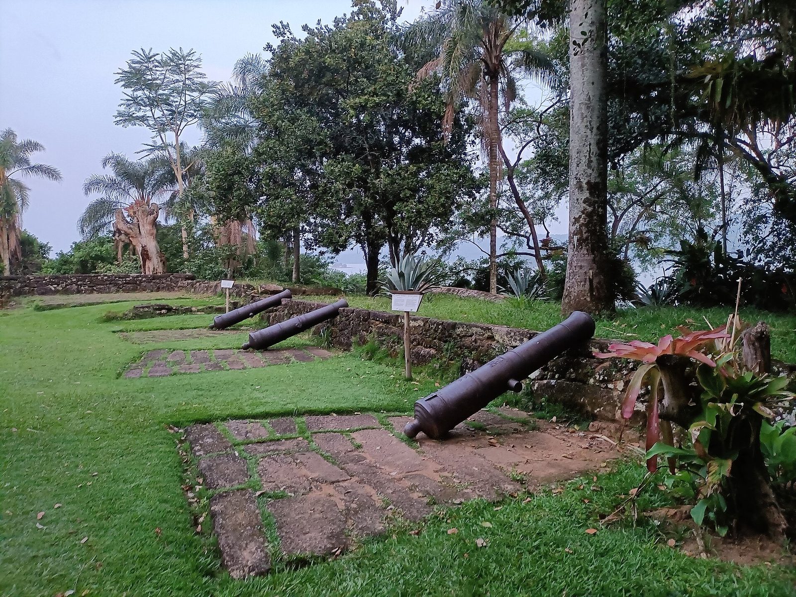
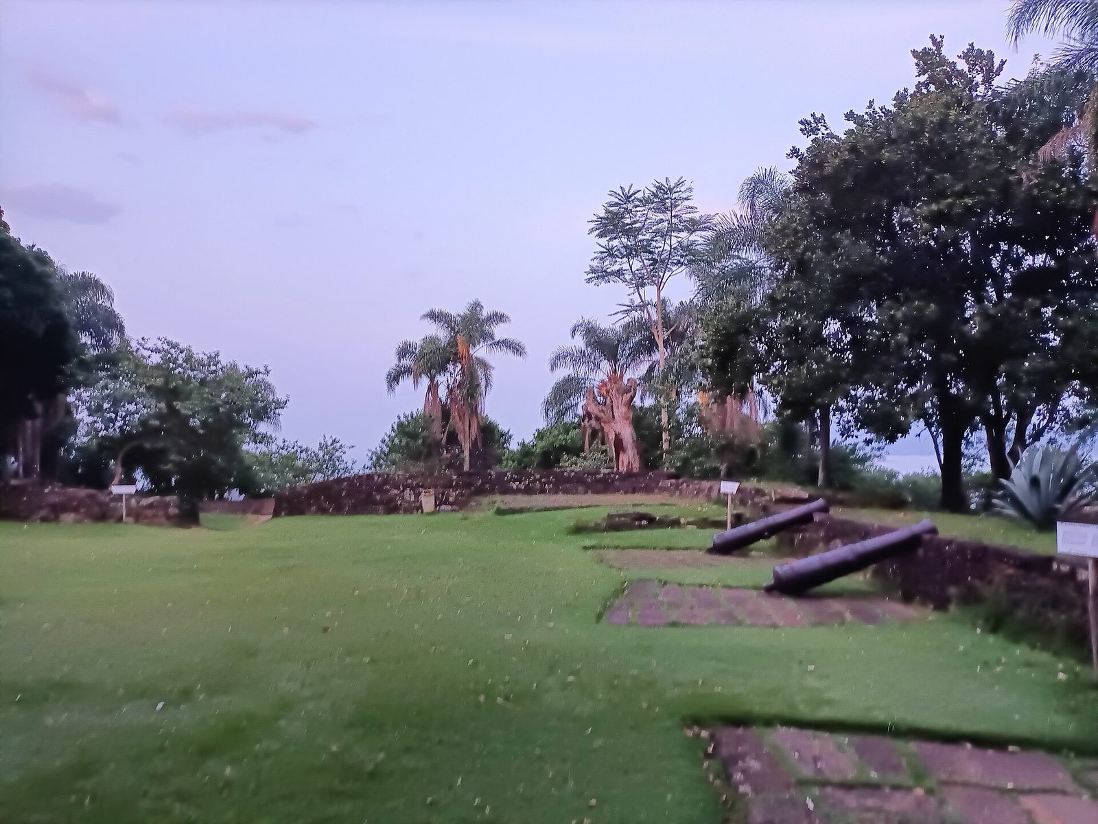
What survives is modest but real — thick lime-washed walls, a scatter of old iron cannons, a powder store and a few low buildings, all set on a grassy platform with the bay laid out below. It is not a vast European-style fortress, and you should not arrive expecting one. It is a small, human-scaled fort in a superb position, and the position is the point. Stand where the guns stand and you understand in a glance why anyone building a defense for this town would build it here.
The walk up from Praia do Pontal
Getting to the fort is a walk, and a pleasant one, though not a flat stroll. From the historic center you cross the Perequê-Açu river — the river that forms the northern edge of the old town — over the bridge to the neighborhood and beach of Pontal. From there a road and track climb the hill to the fort, winding up through trees with the water dropping away below you. On foot it is roughly twenty minutes from the beach, uphill much of the way, with some shade but a couple of open stretches that bake in the midday sun. It is well within the reach of anyone reasonably mobile, but it is a real little climb, not a level promenade, and in the heat of the day it will get your shirt wet.
You can also drive or take a taxi most of the way up, which is the sensible choice in strong sun, with young children, or if the walk up a hot hill does not appeal. However you arrive, wear proper shoes, carry water, and bring a hat, because the top is open and there is little shelter once you are up there. The reward waits the whole way: even as you climb, the bay keeps opening between the trees, so that the view is not a single payoff at the summit but a slow reveal that builds with every switchback.
The prettiest town on the coast keeps its own best view for anyone willing to climb a hill or push off from the dock.
The cannons and the view over the bay
At the top, the fort opens onto a grassy platform, and this is where most people spend their time. Old iron cannons sit along the seaward edge, pointed out over the water they were placed to defend, and they make the obvious and irresistible foreground for a photograph of the bay beyond. Children clamber on them; everyone leans against them to look out. Beyond the guns the view runs the full width of the anchorage: the town itself low and white to the south, the church towers rising just clear of the terracotta roofs, the scatter of islands out on the bay, the headlands closing the water on either side, and the mountains standing behind the whole scene. On a clear day it is one of the great free views of the coast, and it costs you nothing but the climb.
Take your time up here rather than treating it as a photo stop. The light changes the view completely: hard and flat at midday, long and golden in the last hour before sunset, when the low sun lifts every roofline and the water goes to metal. The fort is an especially good place to understand the town as a whole — from the streets you see fragments, but from here you see the entire preserved center as a single field of white walls and red roofs held between the green mountains and the flat bay, exactly the thing the town's protection rules were written to save.
Inside the fort: the museum and the artisans
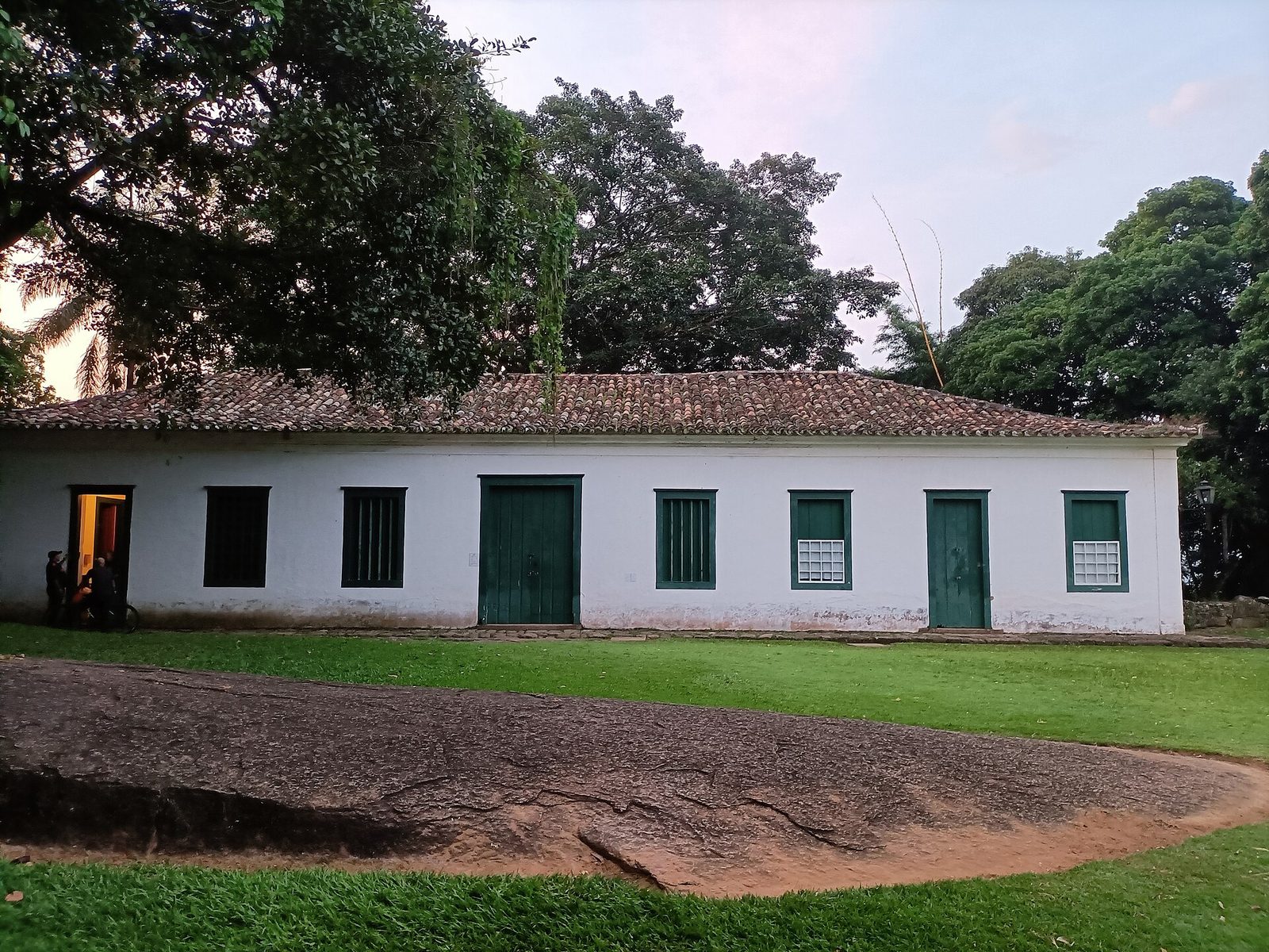
The Forte Defensor Perpétuo is not only a viewpoint. The low whitewashed buildings behind the cannons have been given a second life, and stepping inside is worth the few minutes it takes. The fort now houses a small museum and, alongside it, a center for the region's arts and traditions — a place where local craftspeople show and sell their work, from ceramics and woven pieces to other handmade things of the coast and the mountains behind it. It is a modest operation, not a grand institution, and that suits the building. You come for the fort and the view and find, tucked into the old walls, a quiet place to learn a little of the town's story and to buy something made by hand nearby rather than trucked in for the tourist trade.
The museum side tells the history of Paraty and its region in a small, digestible way — the gold that built the town, the sea that connected it, the life of the port and the coast. It will not take you long, and it is best treated as a companion to the view rather than a destination in itself: read the story, then step back out to the platform and look at the living landscape it describes. The artisan center is the more active half, and the pieces on offer make far better souvenirs than anything in a gift shop, because the money goes more directly to the people who made them.
A practical word: hours here are variable, as they are almost everywhere in Paraty, and the fort or its indoor rooms may be closed on certain days or shut in the middle of the day. Treat any schedule you are given as approximate. Even when the buildings are locked, the grounds, the cannons, and the view are the real reason to make the climb, and those are open to the air. If the museum and the craft rooms are open when you arrive, count it a bonus and go in; if not, the hilltop still gives you the best of what you came for.
The Morro do Forte and the chapel at Vila Velha
The hill the fort stands on carries an old name: the Morro da Vila Velha, the hill of the old town. Locals often call the whole rise simply the Morro do Forte, the fort hill. The name Vila Velha remembers the earliest days of the settlement on this coast, before the town grew into the grid you walk today, and it gives the whole headland a quiet, layered sense of age that rewards a little wandering once you are up there. This is not a single fenced monument but a green hilltop with more than one thing on it, and the fort is only the most obvious.
Near the fort you will find a small chapel and, around it, more places to stand and look out over the bay. The chapel is a plain, modest thing, in keeping with the coast's older buildings, and it adds a note of stillness to the hilltop that the cannons and the visitors do not. You do not need to go inside or know its full history to appreciate it; it is enough to come upon it in its quiet corner, with the water spread out below, and to understand that people have been climbing this hill to look out and to pray for a very long time. If it is open, step in briefly and respectfully; if it is closed, the setting around it is the real gift.
The pleasure of the Morro do Forte is that it packs several viewpoints into one easy climb. From different corners of the hilltop the bay shows itself differently — here framed by the cannons, there over the roofs of Pontal, there again past the chapel toward the open water and the islands. Give yourself half an hour to walk the whole crown of the hill rather than making straight for the guns and leaving. It is the closest high ground to the town, the easiest to reach, and for many visitors it is the single best introduction to what Paraty actually looks like from above.
Paraty from the water at sunset
The view only a boat can give you
The other way to see Paraty whole is to leave it. Push off from the town quay, motor a little way out onto the bay, turn the boat around, and look back — and there is the town you were just standing in, suddenly complete: a low white line at the foot of the mountains, the church towers picked out above the roofs, the whole port small and perfect against the great green rampart of the Serra do Mar. It is a view no amount of walking the streets can give you, because it needs the distance and the elevation of the open water, and it is the reason so many people say their clearest memory of Paraty is of looking back at it from a boat.
The bay itself is the other half of the reward. Once you are afloat you see how the coast is really shaped — the way the water reaches into coves and around headlands, the scatter of green islands, the pale curves of beach and the low sandspits that reach out into the shallows. From the deck you also see the traffic of the harbor as it was meant to be seen, from the water side, the way every arriving ship saw the port for three centuries. The town was built to be approached from the sea, and approaching it from the sea, even now, shows it to you the right way round.
Timing a boat trip for the light
Boat trips of every kind leave from Paraty — larger wooden schooners that make a leisurely loop of the bay, and smaller boats you can hire for a couple of hours or a private outing. Any of them will give you the view back at the town, but if the view is what you are after, time your trip for the end of the day. The light in the last hour before sunset does for the bay what it does for the fort: it turns the water to metal, warms the white walls, and throws the mountains into deep relief. A late-afternoon or sunset cruise, timed so you are out on the water as the sun drops toward the western hills and the far islands, is the version to book.
Do check the practicalities before you commit. Sunset trips return in fading light or after dark, so bring a layer for the cooler air off the water and be sure of how you are getting back to your room afterward. Sea conditions and schedules shift with the weather and the season. For the range of boat trips on the bay, the islands worth aiming for, and how to choose between a big schooner and a small private hire, see our other local guides, which cover the water side of a Paraty stay in more detail than there is room for here.
Pedra da Macela: the great view over the bay
The highest lookout of all
If the fort is the easy view and the boat the loveliest, the Pedra da Macela is the enormous one. This is the high rock lookout on the Serra between Paraty and Cunha, far above the coast on the mountain road that climbs out of the lowlands and over the ridge into São Paulo state. On a clear day the view from the top is on a completely different scale from anything down at sea level: the whole sweep of Paraty bay laid out far below, the islands scattered across the water, the coastline running off in both directions, and, when the air is exceptionally clean, the distant bulk of Ilha Grande out on the horizon. It is the kind of view that reorganizes your mental map of the entire region in a single glance, and it is the natural high point — in every sense — of a day spent chasing vantage points.
The Macela sits on the road up to Cunha, the cool ceramics-and-lavender town on the plateau behind the coast, so the sensible way to reach it is as part of that larger trip. Our full guide to Cunha covers the drive over the mountain, the town at the top, and how to fit the Macela into a day up on the plateau. If all you want is the view, you can drive up, take it in, and come back down without going all the way to Cunha; but most people fold it into the longer day, catching the great view on the way up while the morning air is clearest.
The climb, and the weather that makes or breaks it
Reaching the summit takes some effort. You leave the car at the trailhead area beside the road and climb a steep stone path and stairway the rest of the way up to the bare summit rock, where a cross marks the top. It is short compared to a real mountain hike, but it is genuinely steep, and at altitude it will get your heart going. Wear proper shoes, carry water, take it slowly, and give yourself margin if you are not used to climbs. Families do it with older children all the time; small children will need help and patience on the steps.
The single most important thing to understand about the Macela is that it lives and dies by the weather. On a clear morning it is unforgettable. Inside a cloud it is a cold gray wall and a hard wind, and you will see nothing at all. The mountain makes its own weather, and cloud can roll in and out within minutes, so your odds are best early on a clear, dry day — if you wake to a cloudless morning on the coast, that is your signal to make the Macela your first stop before the day's heat builds cloud on the ridge. Take a warm layer whatever the season; it is markedly colder and windier at the top than at the beach you started from, and people who climb up in shorts and a t-shirt regret it.
Roadside miradouros on the way up and along the coast
Not every good view demands a climb. The roads around Paraty give up several fine ones to anyone willing to pull over, and if steep steps are not for you, these drive-up overlooks are the way to gain height and distance with your legs still fresh. There are two roads to know. The coastal highway — the old Rio–Santos route that threads along this shore — runs high above the sea in places, and where it rounds a headland it opens onto long views over the coves and islands of the coast, with the occasional pullout or roadside stall where you can stop and look. And the mountain road up toward Cunha, climbing the Serra behind the town, is lined with points where the land falls away and the bay appears far below, the Macela being only the grandest of them.
The pleasures and the cautions of both roads are the same. The pleasure is that the views come to you: you gain the height by engine rather than by effort, and the landscape unrolls as you drive. The caution is that these are working roads, often winding, sometimes narrow, and shared with trucks and buses, so the sightseeing has to be done from a proper stopping place and never from behind the wheel at speed. Use the marked pullouts and pátios; do not stop on a blind curve or a narrow shoulder to grab a photo; and remember that the same fog and low cloud that spoil the Macela can settle on any high stretch of these roads and cut the view to nothing.
A few of the roadside overlooks worth slowing for:
- The high stretches of the coastal highway, where the road rounds a shoulder of the Serra and the bay, the coves, and the near islands open below.
- The pullouts on the Paraty–Cunha mountain road, where each gain in altitude widens the view back over the town and the water.
- The Pedra da Macela trailhead itself, where even from the road, before you climb a step, the view is already vast.
- The bridges and river mouths at the edges of town, low-level but lovely, where the Perequê-Açu and the bay meet and the mountains stand behind.
Golden hour, high tide, and the reflected streets
Whichever viewpoint you choose, the same rule governs all of them: the light at the edges of the day is worth arranging your plans around. Paraty at midday, seen from above, is a flat white glare under a hard sun. The same town in the last hour before sunset is a different place entirely — the low light rakes across the roofs, lifts every wall and tower, warms the whitewash to cream and gold, and throws the mountains behind into deep blue shadow. Early morning does much the same in reverse, with soft light and near-empty streets. If you have any freedom in your timing, aim your fort climb, your boat trip, or your drive to a roadside overlook at those two windows and skip the middle of the day, when the view is at its harshest and the heat at its worst.
There is a second piece of timing that belongs only to Paraty, and it is worth planning for if you can. The old center was built low and graded so that on the highest tides of the month — the spring tides around the new and full moon — the sea rises up through the streets, runs along the sloping lanes, and then drains away as the tide falls. For an hour or two the lower streets become shallow sheets of water, and the white walls and the church fronts stand doubled in the mirror over the cobbles. Catch one of those high tides near sunset and the effect is the thing photographers wait years for: the town reflected in its own flooded streets under a warm sky.
From a height, at the right tide and the right hour, the whole preserved center reads as a single low field of white and terracotta held between forest and bay, the church towers rising just clear of the tiles. That is the view the town's protection rules exist to guarantee, and it is best understood from above. Our guide to the town's churches and architecture explains what you are looking at down in those streets — the four churches, the paving, the tide that cleans the lanes — and the view from the fort is the quickest way to see how all of it fits together as one whole.
Drones, cameras, and courtesy
The temptation, faced with a town this photogenic and this hidden, is to send a drone up to get the shot the fort and the boat only hint at. Before you do, stop and think about where you are. Paraty's historic center is a protected, densely visited place, and flying over it is not a free-for-all: rules govern drone use over the heritage core, over crowds, and near the comings and goings of the town, and they exist for good reason. A drone buzzing over a quiet colonial square or a church at prayer is an intrusion, however lovely the footage, and the noise carries a long way over water and stone. Know and follow the local and national rules before you fly, keep well clear of people and of any event or ceremony, and never let the pursuit of an aerial shot override the peace of the place you came to enjoy.
The same courtesy applies to a camera on the ground. The people you photograph — a fisherman on the quay, a craftsman in the fort's artisan rooms, a family in a doorway — are living their lives, not posing for yours, so ask before you point a lens at anyone, and respect a no. Give services and ceremonies a wide berth. The best images of Paraty are rarely the ones grabbed at someone else's expense; they are the ones earned by patience, by good light, and by standing in the right place at the right hour. For a fuller look at where and when to make the best pictures here, and how to do it without stepping on the town, see our Paraty photography guide.
Reaching each viewpoint, and the effort involved
It helps to see the viewpoints as a range of options sorted by effort, so you can match one to your day, your fitness, and the weather. Some you can reach in flip-flops; one demands a real climb at altitude; one needs a boat. None of them is out of reach for an ordinary visitor with a little planning, but they are not interchangeable, and knowing the difference saves you from arriving at the wrong one dressed for the wrong thing.
- Easiest, the water. A boat trip from the town quay asks nothing of your legs. You board at the pier and let the boat do the work; the only planning is choosing your trip and timing it for the late-day light.
- Easy to moderate, the fort and Vila Velha. A twenty-minute uphill walk from Praia do Pontal across the Perequê-Açu river, or a short drive most of the way up. Real but gentle effort, best avoided in the full midday heat.
- Drive-up, the roadside miradouros. No walking to speak of, just a car and a willingness to use the marked pullouts on the coastal and mountain roads.
- Hard, Pedra da Macela. A steep stone stairway to a high summit, reached by a long, winding drive up the mountain toward Cunha. The biggest view and the biggest commitment of the day.
For the fort and the boat you need nothing more than the town itself and a good pair of shoes. For the roadside overlooks and the Macela you need a vehicle and a sensible approach to a mountain road, and it is worth reading how to reach and drive this whole area — the airports, the coastal highway, the transfer up from Paraty — before you set out. Our getting there guide lays out the practical side of arriving and moving around, including the drive over the Serra that carries you past the Macela and on toward Cunha.
Honest safety: steep trails, heat, and the drive home
The viewpoints around Paraty are not dangerous places, but they are real ones, and a few of them have hurt careless visitors. The commonest problem is the simplest: heat and sun. The walk up to the fort, the open hilltop, the exposed summit of the Macela, the deck of a boat — all of them put you out in strong tropical sun, often at the hottest part of the day, and Paraty's humidity makes the heat feel worse than the number suggests. Carry water, wear a hat and sunscreen, climb in the cooler hours where you can, and do not push a hot uphill walk if you are already feeling the heat. Heat exhaustion sneaks up on people who thought they were just going to look at a view.
The second hazard is footing. The stone steps and paths — the climb to the fort, the stairway up the Macela, the cobbles of the town itself — are hard, uneven, and genuinely slick when wet, and a slip on wet stone is the way most visitors here come to grief. Wear closed shoes with real grip, watch your feet as much as the scenery, and take particular care after rain and on the way down, when tired legs and gravity conspire against you. The Macela in poor weather adds cold and wind to the mix; if the summit is buried in cloud, there is no view to be had and no shame in turning back.
The third is the one people forget until it is on them: getting home in the dark. A sunset is the best time to be at a viewpoint and the start of the trickiest trip back. The mountain road toward Cunha and the Macela is no place to be learning the curves in the dark or the fog, and the walk down from the fort or the descent from a boat in fading light needs care too. Plan the return before you go up, not after.
A sunset means a trip home in the dark
The reward for staying out to golden hour is a dark journey back, so plan it before you climb or set sail. Carry a light for the walk down from the fort. Do not start up the mountain road toward the Macela so late that you will be driving its curves in the dark or the fog on the way down. If you are out on a sunset boat trip, know exactly how you are getting from the quay to your room afterward. The view is worth staying for — just decide how you are getting home before the sun is gone.
The view from higher up: back to the reserve
Spend a day chasing the views of Paraty and one idea settles in: this is a place that keeps its best self for those willing to gain a little height or a little distance. Down in the streets it is lovely but enclosed; from the fort, from the water, from the great rock on the mountain road, it becomes something larger — a whole coast of forest and bay and island, with the small white town at the foot of it. The town does not give that away to anyone who merely walks through. You have to climb a hill, or push off from a dock, or drive up into the Serra, and the earning is part of the reward.
The best of this coast is not down in the streets but up on the high ground, where the whole of it finally comes into view.
That is a lesson we live by up at the reserve, on the other side of the same mountains. Reserva Sete Quedas sits high above Paraty, on eight hundred acres of protected Atlantic Forest and old organic banana farm, above the seven waterfalls that give the valley its name. Our own high ground gives the same gift the fort and the Macela give — the long view, the whole landscape at once, the sense of where you actually are — but it gives it quietly, from among the trees, with the sound of falling water instead of a crowd. The town below teaches you to climb for the view; up here, the view is simply where you wake.
If that pairing appeals — a morning at the fort and an evening on the water, then a climb back up into the forest and the quiet at the end of the day — it makes for a rich few days on this coast. You can plan the shape of it through our other local guides, and when you are ready to choose your dates and settle into the high ground above the waterfalls, our stays and booking page is the place to begin. Climb for the view while you are down in the town; come up to the reserve to live inside one.